
Africa
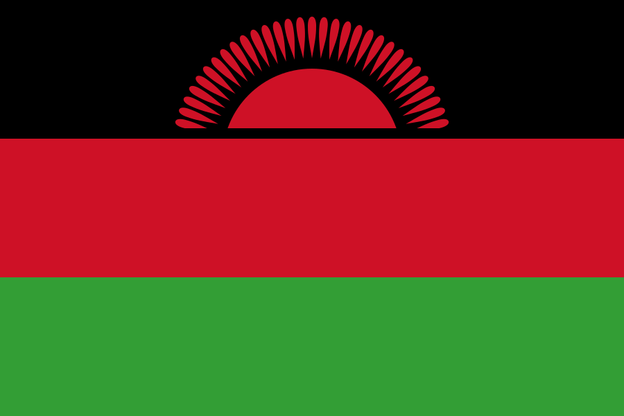
Malawi: flag, map, capital and facts
Everything about Malawi: its flag, its map and its facts.
- Capital
- Lilongwe
- Population
- 22.2 million
- Area
- 118,484 km²
- Currency
- Malawian Kwacha (MK)
#61 by population · #98 by area · #146 economy in the world · #46 by population density
Population and society
Population of mw, 1960–2025. From 3.6 million in 1960 to 22.2 million in 2025.
- Population density
- 230 per km² (rank 46 of 194)
- Urban population
- 17.6% (2025)
- Under 15
- 40.1% (2025)
- Over 65
- 2.6% (2025)
- Children per woman
- 3.59 (2024)
- Internet users
- 19% (2024)
Economy and nature
- GDP
- $14.9B (rank 146 of 194)
- Unemployment
- 5.1% (2025)
- Inflation
- 28.4% (2025)
- Forests
- 22% (of its land · 2024)
- CO₂ per person
- 0.2 t (a year · 2024)
- Lowest point
- 37 m (Shire River)
Figures: World Bank, latest year with data. Lowest point: reviewed by hand.
Symbols

- Anthem
- Mulungu dalitsa Malaŵi
- Official name
- Republic of Malawi · Dziko la Malaŵi
- Motto
- Unity and Freedom (English)
Coat of arms and anthem: Wikimedia Commons. Authors, where the licence asks for it: Coat of arms (CC BY-SA 3.0, Sodacan).

Practical facts
- Official language
- English
- Calling code
- +265
- Internet domain
- .mw
- Driving side
- On the left
- Time zone
- UTC+2
- Demonym
- Malawian
Geography
- Continent
- Africa
- Neighbouring countries
- Mozambique, Tanzania, Zambia
- Highest point
- Mulanje Massif (3,002 m)
- Largest city
- Lilongwe, the capital
- Access to the sea
- No (landlocked)
History and politics
- Form of government
- Presidential republic
- Independence from
- United Kingdom (1964)
Economy and life
- GDP per person
- $672 (2025)
- Life expectancy
- 67.6 years (2024)
- Human Development Index
- 0.517 (rank 172 of 193)
Districts in figures
| Name | Population | Area (km²) |
|---|---|---|
| Balaka | — | 2,193 |
| Blantyre | — | 1,785 |
| Chikwawa | — | — |
| Chiradzulu | — | 767 |
| Chitipa | — | 4,288 |
| Dedza | — | 3,624 |
| Dowa | — | 3,041 |
| Karonga | 269,890 (2008) | 3,355 |
| Kasungu | — | 7,878 |
| Likoma | — | 18 |
| Lilongwe | — | 5,757 |
| Machinga | — | 3,771 |
| Mangochi | — | 6,273 |
| Mchinji | — | 3,356 |
| Mulanje | — | 2,056 |
| Mwanza | — | 2,259 |
| Mzimba | — | 10,430 |
| Neno | — | 1,554 |
| Nkhata Bay | — | 4,071 |
| Nkhotakota | — | 4,259 |
| Nsanje | — | 1,942 |
| Ntcheu | — | 3,424 |
| Ntchisi | — | 1,655 |
| Phalombe | 429,450 (2018) | 1,394 |
| Rumphi | — | 4,071 |
| Salima | — | 2,196 |
| Thyolo | — | 1,715 |
| Zomba | — | 2,580 |
Capitals, population and area: Wikidata. The year of each population is in brackets.
Its flags over time
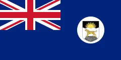 Malawi · 1914–1919
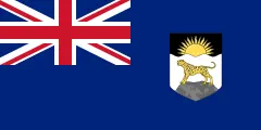 Malawi · 1919–1925
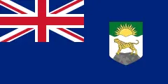 Malawi · 1925–1964
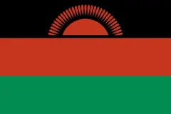 Malawi · 1964–2010
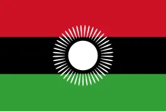 Malawi · 2010–2012
- Malawi · 2012–today
Flags: Wikimedia Commons. Authors, where the licence asks for it: 1925–1964 (CC BY-SA 4.0, Fry1989 eh?).

Frequently asked questions
What is the capital of Malawi?
Lilongwe
How many people live in Malawi?
22.2 million inhabitants (2025)
What currency is used in Malawi?
Malawian Kwacha
What is the official language of Malawi?
English
What is the calling code of Malawi?
+265
Which countries border Malawi?
Mozambique, Tanzania, and Zambia
What is the highest point of Malawi?
Mulanje Massif (3,002 m)
Play Malawi · Flag of Malawi · Country fact sheets · Maps: Africa · Geotaria
Data: World Bank (population, economy), UNDP (human development), Wikidata, GeoNames and mledoze/countries.