
Asia
Sri Lanka: flag, map, capital and facts
Everything about Sri Lanka: its flag, its map and its facts.
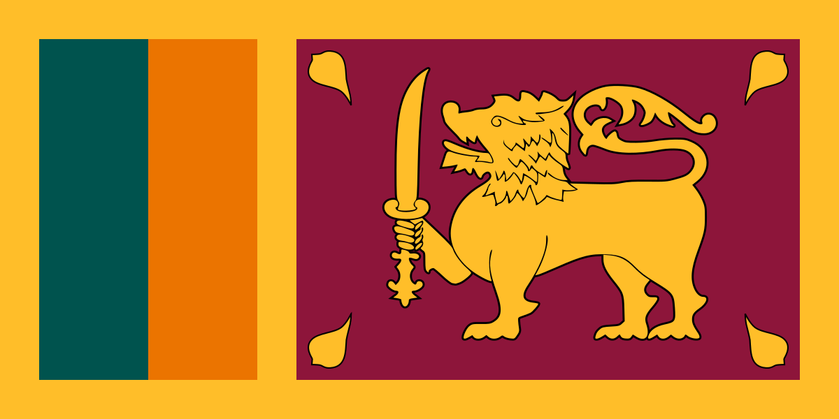
- Capital
- Sri Jayawardenepura Kotte
- Population
- 21.8 million
- Area
- 65,610 km²
- Currency
- Sri Lankan Rupee (Rs රු)
#63 by population · #120 by area · #70 economy in the world · #24 by population density
Population and society
Population of lk, 1960–2025. From 9.7 million in 1960 to 21.8 million in 2025. Its peak: 22.2 million in 2022.
- Population density
- 354 per km² (rank 24 of 194)
- Urban population
- 20.5% (2025)
- Under 15
- 21.7% (2025)
- Over 65
- 12.5% (2025)
- Children per woman
- 1.95 (2024)
- Internet users
- 54.6% (2024)
Economy and nature
- GDP
- $108.8B (rank 70 of 194)
- Unemployment
- 4% (2025)
- Inflation
- -4.8% (2025)
- Forests
- 34.4% (of its land · 2024)
- CO₂ per person
- 1.1 t (a year · 2024)
- Lowest point
- 0 m (sea level)
Figures: World Bank, latest year with data. Lowest point: reviewed by hand.
Symbols

- Anthem
- Sri Lanka Matha (ශ්රී ලංකා මාතා)
- Official name
- ශ්රී ලංකා ප්රජාතාන්ත්රික සමාජවාදී ජනරජය · இலங்கை சனநாயக சோசலிசக் குடியரசு
Coat of arms and anthem: Wikimedia Commons.
Practical facts
- Official languages
- Sinhala and Tamil
- Calling code
- +94
- Internet domain
- .lk, .இலங்கை, .ලංකා
- Driving side
- On the left
- Time zone
- UTC+5:30
- Demonym
- Sri Lankan
Geography
- Continent
- Asia
- Neighbouring countries
- None: no land borders
- Highest point
- Pidurutalagala (2,524 m)
- Largest city
- Colombo
- Access to the sea
- Yes
History and politics
- Form of government
- Semi-presidential republic
- Independence from
- United Kingdom (1948)
Economy and life
- GDP per person
- $5,002 (2025)
- Life expectancy
- 77.7 years (2024)
- Human Development Index
- 0.776 (rank 89 of 193)
Districts in figures
| Name | Capital | Population | Area (km²) |
|---|---|---|---|
| Ampāra | — | — | 4,415 |
| Anurādhapura | — | 860,575 (2012) | 7,179 |
| Badulla | — | — | 2,861 |
| Gālla (Galle District) | Galle | 1,058,771 (2012) | 1,652 |
| Gampaha | — | — | 1,387 |
| Hambantŏṭa | — | — | 2,609 |
| Kægalla (Kegalle District) | Kegalle | — | 1,693 |
| Kaḷutara | — | — | 1,598 |
| Kilinŏchchi | — | — | 1,279 |
| Kŏḷamba (Colombo District) | Colombo | — | 699 |
| Kuruṇægala (Kurunegala District) | Kurunegala | — | 4,816 |
| Maḍakalapuva (Batticaloa District) | Batticaloa | — | 2,854 |
| Mahanuvara (Kandy District) | Kandy | — | 1,940 |
| Mannārama (Mannar District) | — | — | 1,996 |
| Mātale | — | — | 1,993 |
| Mātara | — | — | 1,283 |
| Mŏṇarāgala | — | — | 5,636 |
| Mulativ (Mullaitivu District) | Mullaitivu(මූලදීපය) | — | 2,617 |
| Nuvara Ĕliya (Nuwara Eliya District) | Nuwara Eliya | — | 1,741 |
| Pŏḷŏnnaruva (Polonnaruwa District) | Polonnaruwa | — | 3,293 |
| Puttalama (Puttalam District) | Puttalam | 760,778 (2012) | 3,072 |
| Ratnapura | — | — | 3,275 |
| Trikuṇāmalaya (Trincomalee District) | Trincomalee | — | 2,727 |
| Vavuniyāva (Vavuniya District) | — | — | 1,967 |
| Yāpanaya (Jaffna District) | Jaffna | — | 1,025 |
Capitals, population and area: Wikidata. The year of each population is in brackets.
Its flags over time
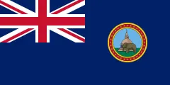 Sri Lanka · 1875–1948
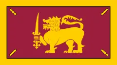 Sri Lanka · 1948–1951
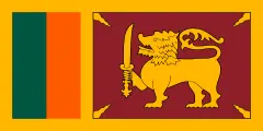 Sri Lanka · 1951–1972
- Sri Lanka · 1972–today
Flags: Wikimedia Commons.
Frequently asked questions
What is the capital of Sri Lanka?
Sri Jayawardenepura Kotte
How many people live in Sri Lanka?
21.8 million inhabitants (2025)
What currency is used in Sri Lanka?
Sri Lankan Rupee
What are the official languages of Sri Lanka?
Sinhala and Tamil
What is the calling code of Sri Lanka?
+94
Which countries border Sri Lanka?
None: no land borders
What is the highest point of Sri Lanka?
Pidurutalagala (2,524 m)
Play Sri Lanka · Flag of Sri Lanka · Country fact sheets · Maps: Asia · Geotaria
Data: World Bank (population, economy), UNDP (human development), Wikidata, GeoNames and mledoze/countries.