
Geotaria · Lesotho
Lesotho: wilayah (tingkat kedua)
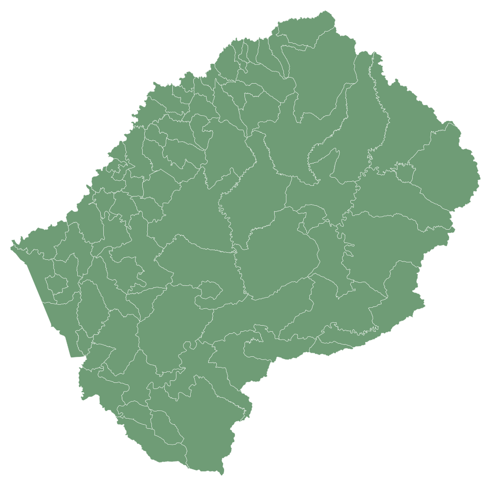
Sebutkan wilayah di Lesotho dan isi petanya.
Tentang peta ini
Peta Lesotho ini memiliki 78 wilayah. Ketik nama-namanya dari ingatan dalam urutan apa pun, dan setiap jawaban benar akan mewarnai peta.
Tanpa instalasi atau pendaftaran: tekan Mulai lalu ketik. Dengan akun, rekor terbaik disimpan dan kamu bisa menantang teman dalam pertandingan 1 lawan 1.
Lesotho — ibu kota: Maseru; penduduk: 2,4 juta (2025); luas: 30.355 km². Berbatasan dengan Afrika Selatan.
Pertanyaan umum
Ada berapa wilayah di peta Lesotho ini?
Peta Lesotho ini memiliki 78 wilayah.
Apa saja wilayah di Lesotho?
'Maoa-Mafubelu, Bokong, Bolahla, Butha-Buthe (Butha-Buthe District), Butha-Buthe (Leribe District), Hleoheng, Kanana, Khoelenya, Khutlo-se-Metsi, Kubake, Kueneng, Lehlakaneng, Leribe, Likila, Likolobeng, Lilala, Linakeng, Lithipeng, Litjotjela, Litsoetse, Mafeteng, Maisa-Phoka, Makeoana, Makhoalipana, Makhoarane, Makoabating, Mamants'o, Manka, Manonyane, Mapoteng, Maputsoe, Maseru (Berea Distict), Maseru (Maseru District), Mashaleng, Matsoku, Menkhoaneng, Menoaneng, Metsi-Maholo, Mjanyane, Mohale's Hoek, Mohlakeng, Mokhotlong, Motanasela, Mphaki, Mphokojoana, Ngoajane, Nqoe, Ntsupe, Phuthiatsana, Qacha's Nek, Qanya, Qhoasing, Qibing, Qiloane, Qomoqomong, Quthing, Ramapepe, Ramoetsana, Ratau, Sanqebethu, Seate, Semonkong, Senekane, Senqunyane, Sephokong, Siloe, Tayateyaneng, Tebe-Tebe, Telle, Tenesolo, Thaba-Mokhele, Thaba-Tseka, Thota-ea-Moli, Tosing, Tsa-le-Moleka, Tsana-Talana, Tsoelikana, dan Tsuili-Tsuili.
Berapa banyak wilayah di setiap wilayah Lesotho?
Distrik Berea: 9; Distrik Butha-Buthe: 5; Distrik Leribe: 13; Distrik Mafeteng: 8; Distrik Maseru: 13; Distrik Mohale's Hoek: 8; Distrik Mokhotlong: 6; Distrik Qacha's Nek: 4; Distrik Quthing: 6; Distrik Thaba-Tseka: 6.
Apakah nama harus diketik persis?
Huruf besar dan aksen tidak berpengaruh. Satu kata utuh cukup jika hanya menunjukkan satu wilayah; potongan kata tidak dihitung.
Lesotho: distrik (10) · Bendera Lesotho · Lesotho: bendera, peta, ibu kota, dan fakta · Geotaria
Wilayah dalam angka
| Nama | distrik | Penduduk | Luas (km²) |
|---|---|---|---|
| 'Maoa-Mafubelu | Distrik Leribe | — | 155 |
| Bokong | Distrik Thaba-Tseka | — | 674 |
| Bolahla | Distrik Leribe | — | 280 |
| Butha-Buthe (Butha-Buthe District) | Distrik Butha-Buthe | 10.000 (2004) | 66 |
| Butha-Buthe (Leribe District) | Distrik Leribe | — | 31 |
| Hleoheng | Distrik Leribe | — | 65 |
| Kanana | Distrik Berea | — | 105 |
| Khoelenya | Distrik Mohale's Hoek | — | 323 |
| Khutlo-se-Metsi | Distrik Thaba-Tseka | — | 1.232 |
| Kubake | Distrik Maseru | — | 538 |
| Kueneng | Distrik Berea | — | 142 |
| Lehlakaneng | Distrik Mafeteng | — | 417 |
| Leribe | Distrik Leribe | — | 86 |
| Likila | Distrik Butha-Buthe | 19.340 (2006) | 153 |
| Likolobeng | Distrik Maseru | — | 1.127 |
| Lilala | Distrik Maseru | — | 287 |
| Linakeng | Distrik Thaba-Tseka | — | 1.328 |
| Lithipeng | Distrik Mohale's Hoek | — | 440 |
| Litjotjela | Distrik Leribe | — | 74 |
| Litsoetse | Distrik Thaba-Tseka | — | 483 |
| Mafeteng | Distrik Mafeteng | 57.059 (2005) | 74 |
| Maisa-Phoka | Distrik Leribe | — | 61 |
| Makeoana | Distrik Berea | — | 589 |
| Makhoalipana | Distrik Maseru | — | 908 |
| Makhoarane | Distrik Maseru | — | 219 |
| Makoabating | Distrik Mafeteng | — | 309 |
| Mamants'o | Distrik Mafeteng | — | 270 |
| Manka | Distrik Leribe | — | 170 |
| Manonyane | Distrik Maseru | — | 132 |
| Mapoteng | Distrik Berea | — | 126 |
| Maputsoe | Distrik Leribe | 32.117 (2005) | 54 |
| Maseru (Berea Distict) | Distrik Maseru | — | 40 |
| Maseru (Maseru District) | Distrik Maseru | 343.541 (2016) | 142 |
| Mashaleng | Distrik Mohale's Hoek | — | 72 |
| Matsoku | Distrik Mokhotlong | — | 1.011 |
| Menkhoaneng | Distrik Leribe | — | 308 |
| Menoaneng | Distrik Mokhotlong | — | 870 |
| Metsi-Maholo | Distrik Mafeteng | — | 276 |
| Mjanyane | Distrik Quthing | — | 349 |
| Mohale's Hoek | Distrik Mohale's Hoek | 24.992 (2006) | 129 |
| Mohlakeng | Distrik Maseru | — | 144 |
| Mokhotlong | Distrik Mokhotlong | 8.809 (2005) | 75 |
| Motanasela | Distrik Berea | — | 250 |
| Mphaki | Distrik Quthing | — | 502 |
| Mphokojoana | Distrik Mokhotlong | — | 1.066 |
| Ngoajane | Distrik Butha-Buthe | — | 322 |
| Nqoe | Distrik Butha-Buthe | — | 1.116 |
| Ntsupe | Distrik Qacha's Nek | — | 914 |
| Phuthiatsana | Distrik Berea | — | 185 |
| Qacha's Nek | Distrik Qacha's Nek | — | 101 |
| Qanya | Distrik Qacha's Nek | — | 362 |
| Qhoasing | Distrik Mohale's Hoek | — | 1.046 |
| Qibing | Distrik Mafeteng | — | 272 |
| Qiloane | Distrik Maseru | — | 99 |
| Qomoqomong | Distrik Quthing | 6.760 (2006) | 166 |
| Quthing | Distrik Quthing | 15.000 (2004) | 137 |
| Ramapepe | Distrik Leribe | — | 199 |
| Ramoetsana | Distrik Mafeteng | — | 322 |
| Ratau | Distrik Maseru | — | 221 |
| Sanqebethu | Distrik Mokhotlong | — | 1.013 |
| Seate | Distrik Mokhotlong | — | 1.156 |
| Semonkong | Distrik Maseru | — | 75 |
| Senekane | Distrik Berea | — | 245 |
| Senqunyane | Distrik Mohale's Hoek | — | 907 |
| Sephokong | Distrik Leribe | — | 153 |
| Siloe | Distrik Mohale's Hoek | — | 315 |
| Tayateyaneng | Distrik Berea | — | 78 |
| Tebe-Tebe | Distrik Berea | — | 218 |
| Telle | Distrik Quthing | — | 601 |
| Tenesolo | Distrik Thaba-Tseka | — | 1.031 |
| Thaba-Mokhele | Distrik Mohale's Hoek | — | 465 |
| Thaba-Tseka | Distrik Thaba-Tseka | 5.423 (2005) | 119 |
| Thota-ea-Moli | Distrik Maseru | — | 108 |
| Tosing | Distrik Quthing | — | 1.222 |
| Tsa-le-Moleka | Distrik Butha-Buthe | — | 134 |
| Tsana-Talana | Distrik Mafeteng | — | 211 |
| Tsoelikana | Distrik Qacha's Nek | — | 755 |
| Tsuili-Tsuili | Distrik Leribe | — | 186 |
Luas: geoBoundaries. Wilayah, ibu kota, dan penduduk: Wikidata; tahun setiap data penduduk ada dalam kurung.
Peta lainnya: Afrika
- Angola
- Aljazair
- Benin
- Botswana
- Burkina Faso
- Burundi
- Tanjung Verde
- Kamerun
- Chad
- Komoro
- Côte d’Ivoire
- Mesir
- Eritrea
- eSwatini
- Etiopia
- Gabon
- Gambia
- Ghana
- Guinea
- Guinea-Bissau
- Guinea Ekuatorial
- Kenya
- Liberia
- Libya
- Madagaskar
- Malawi
- Mali
- Maroko
- Mauritius
- Mauritania
- Mozambik
- Namibia
- Niger
- Nigeria
- Republik Afrika Tengah
- Kongo - Brazzaville
- Kongo - Kinshasa
- Rwanda
- Sao Tome dan Principe
- Senegal
- Seychelles
- Sierra Leone
- Somalia
- Afrika Selatan
- Sudan
- Sudan Selatan
- Tanzania
- Togo
- Tunisia
- Uganda
- Jibuti
- Zambia
- Zimbabwe