
Geotaria · Lesotho
Lesotho: bölgeler (ikinci düzey)
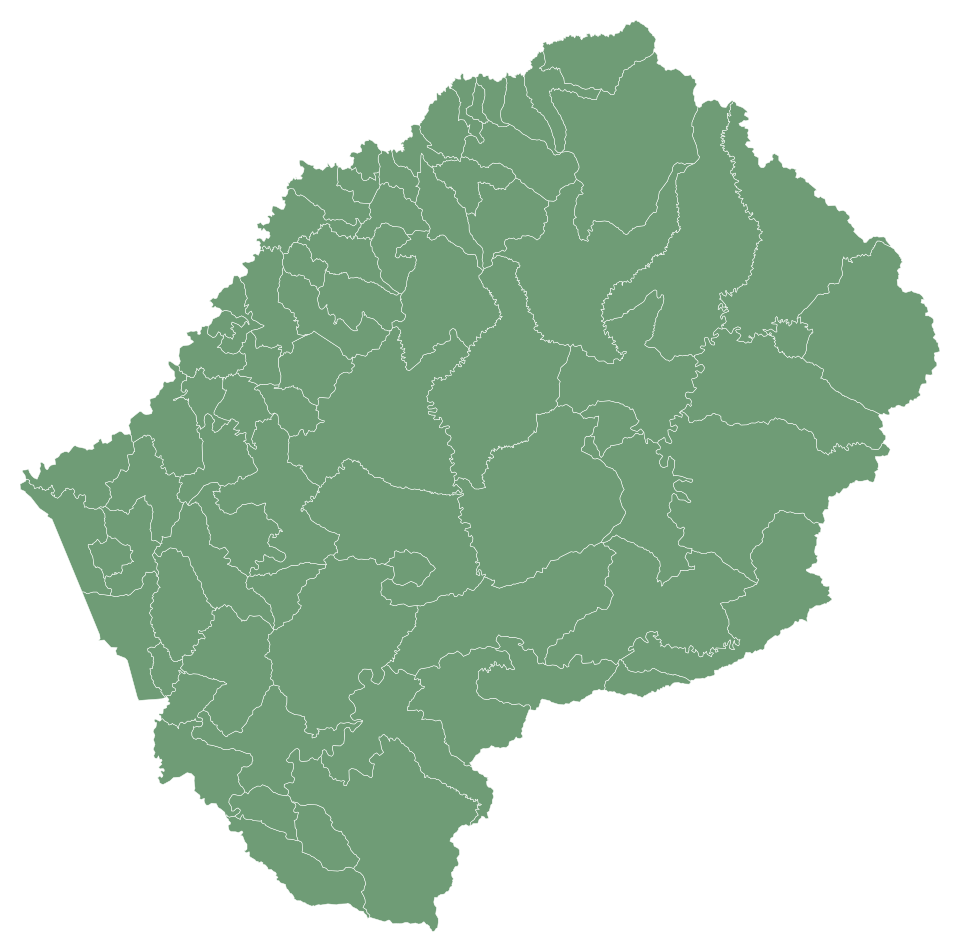
Lesotho haritasında bölgeler adlarını yaz ve haritayı doldur.
Bu harita hakkında
Bu Lesotho haritasında 78 bölgeler var. Adlarını hafızadan istediğin sırayla yaz; doğru cevaplar haritada renklensin.
Yükleme veya kayıt gerekmez: Başla'ya bas ve yaz. Hesabınla en iyi sonuçlarını kaydedip arkadaşınla 1'e 1 oynayabilirsin.
Lesotho — başkent: Maseru; nüfus: 2,4 milyon (2025); yüzölçümü: 30.355 km². Komşu ülkeler: Güney Afrika.
Sık sorulan sorular
Bu Lesotho haritasında kaç bölgeler var?
Bu Lesotho haritasında 78 bölgeler var.
Lesotho: bölgeler hangileridir?
'Maoa-Mafubelu, Bokong, Bolahla, Butha-Buthe (Butha-Buthe District), Butha-Buthe (Leribe District), Hleoheng, Kanana, Khoelenya, Khutlo-se-Metsi, Kubake, Kueneng, Lehlakaneng, Leribe, Likila, Likolobeng, Lilala, Linakeng, Lithipeng, Litjotjela, Litsoetse, Mafeteng, Maisa-Phoka, Makeoana, Makhoalipana, Makhoarane, Makoabating, Mamants'o, Manka, Manonyane, Mapoteng, Maputsoe, Maseru (Berea Distict), Maseru (Maseru District), Mashaleng, Matsoku, Menkhoaneng, Menoaneng, Metsi-Maholo, Mjanyane, Mohale's Hoek, Mohlakeng, Mokhotlong, Motanasela, Mphaki, Mphokojoana, Ngoajane, Nqoe, Ntsupe, Phuthiatsana, Qacha's Nek, Qanya, Qhoasing, Qibing, Qiloane, Qomoqomong, Quthing, Ramapepe, Ramoetsana, Ratau, Sanqebethu, Seate, Semonkong, Senekane, Senqunyane, Sephokong, Siloe, Tayateyaneng, Tebe-Tebe, Telle, Tenesolo, Thaba-Mokhele, Thaba-Tseka, Thota-ea-Moli, Tosing, Tsa-le-Moleka, Tsana-Talana, Tsoelikana ve Tsuili-Tsuili.
Lesotho: her bölgede kaç bölgeler var?
Berea District: 9; Butha-Buthe Bölgesi: 5; Leribe District: 13; Mafeteng District: 8; Maseru District: 13; Mohale's Hoek District: 8; Mokhotlong District: 6; Qacha's Nek District: 4; Quthing Distring: 6; Thaba-Tseka District: 6.
Adları tam doğru yazmalı mıyım?
Büyük harf ve aksan fark etmez. Tek bölgeyi belirten tam bir kelime yeterli olabilir; kelime parçası sayılmaz.
Lesotho: ilçeler (10) · Lesotho bayrağı · Lesotho: bayrak, harita, başkent ve bilgiler · Geotaria
Rakamlarla bölgeler
| Ad | ilçeler | Nüfus | Yüzölçümü (km²) |
|---|---|---|---|
| 'Maoa-Mafubelu | Leribe District | — | 155 |
| Bokong | Thaba-Tseka District | — | 674 |
| Bolahla | Leribe District | — | 280 |
| Butha-Buthe (Butha-Buthe District) | Butha-Buthe Bölgesi | 10.000 (2004) | 66 |
| Butha-Buthe (Leribe District) | Leribe District | — | 31 |
| Hleoheng | Leribe District | — | 65 |
| Kanana | Berea District | — | 105 |
| Khoelenya | Mohale's Hoek District | — | 323 |
| Khutlo-se-Metsi | Thaba-Tseka District | — | 1.232 |
| Kubake | Maseru District | — | 538 |
| Kueneng | Berea District | — | 142 |
| Lehlakaneng | Mafeteng District | — | 417 |
| Leribe | Leribe District | — | 86 |
| Likila | Butha-Buthe Bölgesi | 19.340 (2006) | 153 |
| Likolobeng | Maseru District | — | 1.127 |
| Lilala | Maseru District | — | 287 |
| Linakeng | Thaba-Tseka District | — | 1.328 |
| Lithipeng | Mohale's Hoek District | — | 440 |
| Litjotjela | Leribe District | — | 74 |
| Litsoetse | Thaba-Tseka District | — | 483 |
| Mafeteng | Mafeteng District | 57.059 (2005) | 74 |
| Maisa-Phoka | Leribe District | — | 61 |
| Makeoana | Berea District | — | 589 |
| Makhoalipana | Maseru District | — | 908 |
| Makhoarane | Maseru District | — | 219 |
| Makoabating | Mafeteng District | — | 309 |
| Mamants'o | Mafeteng District | — | 270 |
| Manka | Leribe District | — | 170 |
| Manonyane | Maseru District | — | 132 |
| Mapoteng | Berea District | — | 126 |
| Maputsoe | Leribe District | 32.117 (2005) | 54 |
| Maseru (Berea Distict) | Maseru District | — | 40 |
| Maseru (Maseru District) | Maseru District | 343.541 (2016) | 142 |
| Mashaleng | Mohale's Hoek District | — | 72 |
| Matsoku | Mokhotlong District | — | 1.011 |
| Menkhoaneng | Leribe District | — | 308 |
| Menoaneng | Mokhotlong District | — | 870 |
| Metsi-Maholo | Mafeteng District | — | 276 |
| Mjanyane | Quthing Distring | — | 349 |
| Mohale's Hoek | Mohale's Hoek District | 24.992 (2006) | 129 |
| Mohlakeng | Maseru District | — | 144 |
| Mokhotlong | Mokhotlong District | 8.809 (2005) | 75 |
| Motanasela | Berea District | — | 250 |
| Mphaki | Quthing Distring | — | 502 |
| Mphokojoana | Mokhotlong District | — | 1.066 |
| Ngoajane | Butha-Buthe Bölgesi | — | 322 |
| Nqoe | Butha-Buthe Bölgesi | — | 1.116 |
| Ntsupe | Qacha's Nek District | — | 914 |
| Phuthiatsana | Berea District | — | 185 |
| Qacha's Nek | Qacha's Nek District | — | 101 |
| Qanya | Qacha's Nek District | — | 362 |
| Qhoasing | Mohale's Hoek District | — | 1.046 |
| Qibing | Mafeteng District | — | 272 |
| Qiloane | Maseru District | — | 99 |
| Qomoqomong | Quthing Distring | 6.760 (2006) | 166 |
| Quthing | Quthing Distring | 15.000 (2004) | 137 |
| Ramapepe | Leribe District | — | 199 |
| Ramoetsana | Mafeteng District | — | 322 |
| Ratau | Maseru District | — | 221 |
| Sanqebethu | Mokhotlong District | — | 1.013 |
| Seate | Mokhotlong District | — | 1.156 |
| Semonkong | Maseru District | — | 75 |
| Senekane | Berea District | — | 245 |
| Senqunyane | Mohale's Hoek District | — | 907 |
| Sephokong | Leribe District | — | 153 |
| Siloe | Mohale's Hoek District | — | 315 |
| Tayateyaneng | Berea District | — | 78 |
| Tebe-Tebe | Berea District | — | 218 |
| Telle | Quthing Distring | — | 601 |
| Tenesolo | Thaba-Tseka District | — | 1.031 |
| Thaba-Mokhele | Mohale's Hoek District | — | 465 |
| Thaba-Tseka | Thaba-Tseka District | 5.423 (2005) | 119 |
| Thota-ea-Moli | Maseru District | — | 108 |
| Tosing | Quthing Distring | — | 1.222 |
| Tsa-le-Moleka | Butha-Buthe Bölgesi | — | 134 |
| Tsana-Talana | Mafeteng District | — | 211 |
| Tsoelikana | Qacha's Nek District | — | 755 |
| Tsuili-Tsuili | Leribe District | — | 186 |
Yüzölçümü: geoBoundaries. Bölge, merkezler ve nüfus: Wikidata; parantez içinde her nüfus verisinin yılı.
Diğer haritalar: Afrika
- Angola
- Cezayir
- Benin
- Botsvana
- Burkina Faso
- Burundi
- Cabo Verde
- Kamerun
- Çad
- Komorlar
- Côte d’Ivoire
- Mısır
- Eritre
- Esvatini
- Etiyopya
- Gabon
- Gambiya
- Gana
- Gine
- Gine-Bissau
- Ekvator Ginesi
- Kenya
- Liberya
- Libya
- Madagaskar
- Malavi
- Mali
- Fas
- Mauritius
- Moritanya
- Mozambik
- Namibya
- Nijer
- Nijerya
- Orta Afrika Cumhuriyeti
- Kongo - Brazavil
- Kongo - Kinşasa
- Ruanda
- Sao Tome ve Principe
- Senegal
- Seyşeller
- Sierra Leone
- Somali
- Güney Afrika
- Sudan
- Güney Sudan
- Tanzanya
- Togo
- Tunus
- Uganda
- Cibuti
- Zambiya
- Zimbabve